- Újdonságok
- ÚTIKÖNYV, TÉRKÉP KIÁRUSÍTÁS! UTOLSÓ DARABOK! OUTLET!
- KAPARÓS TÉRKÉPEK
- Antik falitérképek
- Magyarország közigazgatási falitérképek
- Magyarország úthálózata és domborzati falitérképek
- Egyéb Magyarország falitérképek
- Budapest falitérképek
- Európa falitérképek
- Föld, világ falitérképek
- Domború térképek
- Afrika falitérképek
- Amerika falitérképek
- Ausztrália falitérképek
- Ázsia falitérképek
- Irányítószámos térképek
- Csillagászati falitérképek
- Iskolai falitérképek, iskolai falitablók
- Asztali alátét, könyöklő
- Asztali alátét A/3-as méretben, 42*30 cm
- Kisméretű falitérképek (wandik)
- Kiegészítők falitérképhez
- TÉRKÉPEK KERETBEN TŰZDELHETŐK
- KÉPKERETEK, KÉPKERETEZÉS FA ÉS FÉM KÉPKERET
- NEMZETI HITVALLÁS
- PREZENTÁCIÓ - táblák, flipchart
- ---------------------------
- FÖLDGÖMBÖK, optikai különlegességek
- AUTÓSTÉRKÉPEK, VÁROSTÉRKÉPEK, TÚRISTATÉRKÉPEK
- MAGYARORSZÁG autótérképek, autós atlaszok
- Légiforgalmi térkép - ICAO
- Magyarország megyetérképei
- Magyarország várostérképei
- Katonai térképek 1:50000 ma
- Kerékpáros-, túrista-, vizisport térképek
- BUDAPEST hajtogatott térképek, atlaszok
- Európa és Európa részei autóstérképek
- Európa országai autótérképek, város-, túristatérképek
- Albánia
- Ausztria
- Balti államok
- Benelux államok
- Bulgária
- Ciprus
- Csehország
- Franciaország
- Görögország
- Horvátország, Szlovénia, Bosznia, Szerbia, Montenegro, Macedonia, Koszovó
- Lengyelország
- Nagy-Britannia, Írország
- Németország
- Oroszország
- Olaszország
- Románia autótérképek, várostérképek, turistatérképek
- Skandinávia, Izland
- Spanyolország, Portugália
- Svájc
- Szlovákia
- Ukrajna
- Afrika
- Amerika
- Ausztrália, Indonézia
- Ázsia
- Hajózási térképek
- Reise Know-How vízálló térképek
- Útikönyvek -20%-86% AKCIÓ
- Zsebszótár, társalgási könyvek
- Fa fali dekorációk
- Világatlaszok, történelmi atlaszok
- Iskolai atlaszok
- FIXI tanulói munkalap
- TÖRTÉNELMI TÉRKÉPEK-Magyar História
- Látványtérképek
- Társasjátékok, Térkép puzzle, Térképek gyerekeknek
- BONCAHIER napló
- Könyv
- Éves tervezőnaptár
- Csomagolás
- POSZTER
- Nagyító, iránytű, tájoló
- --------------------------
- VILÁGTÉRKÉPEK
- Egyéb
- TÉRKÉPBOLT
- DIGITÁLIS NYOMTATÁS
Termékek

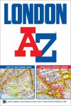
This A-Z London Street Atlas includes 155 pages of our famous standard street mapping at a scale of 2.88 inches to 1 mile, extending to:
•Barnet
•Chingford
•Dagenham
•Sidcup
•Chislehurst
•Farnborough
•Croydon
•Surbiton
•Shepperton
•Heathrow Airport (Terminals 1-5)
•Ruislip
•Stanmore
A large-scale Central London 16 page street map section at 5.75 inches to 1 mile, extending:
•north to Regent's Park and Shoreditch
•south to Chelsea and Vauxhall
•west to Hyde Park
•east to Bermondsey.
Also included is:
•An overview map of the Congestion Charging Zone
•A West End Theatre map
•The London Connections rail services map
•The full London Underground map
Postcode districts, one-way streets, safety camera locations with maximum speed limits and the Congestion Charging Zone are also featured on the mapping.
A comprehensive index lists streets, selected flats, walkways and places of interest, place, area and junction names. There are additional healthcare (hospitals, walk-in centres and hospices) and transport (National Rail, London Tramlink, Docklands Light Railway, London Underground and Overground stations, and River Bus pier) indexes as covered by this atlas.


