
- Újdonságok
- ÚTIKÖNYV, TÉRKÉP KIÁRUSÍTÁS! UTOLSÓ DARABOK! OUTLET!
- KAPARÓS TÉRKÉPEK
- Antik falitérképek
- Magyarország közigazgatási falitérképek
- Magyarország úthálózata és domborzati falitérképek
- Egyéb Magyarország falitérképek
- Budapest falitérképek
- Európa falitérképek
- Föld, világ falitérképek
- Domború térképek
- Afrika falitérképek
- Amerika falitérképek
- Ausztrália falitérképek
- Ázsia falitérképek
- Irányítószámos térképek
- Csillagászati falitérképek
- Iskolai falitérképek, iskolai falitablók
- Asztali alátét, könyöklő
- Asztali alátét A/3-as méretben, 42*30 cm
- Kisméretű falitérképek (wandik)
- Kiegészítők falitérképhez
- TÉRKÉPEK KERETBEN TŰZDELHETŐK
- KÉPKERETEK, KÉPKERETEZÉS FA ÉS FÉM KÉPKERET
- NEMZETI HITVALLÁS
- PREZENTÁCIÓ - táblák, flipchart
- ---------------------------
- FÖLDGÖMBÖK, optikai különlegességek
- AUTÓSTÉRKÉPEK, VÁROSTÉRKÉPEK, TÚRISTATÉRKÉPEK
- MAGYARORSZÁG autótérképek, autós atlaszok
- Légiforgalmi térkép - ICAO
- Magyarország megyetérképei
- Magyarország várostérképei
- Katonai térképek 1:50000 ma
- Kerékpáros-, túrista-, vizisport térképek
- BUDAPEST hajtogatott térképek, atlaszok
- Európa és Európa részei autóstérképek
- Európa országai autótérképek, város-, túristatérképek
- Albánia
- Ausztria
- Balti államok
- Benelux államok
- Bulgária
- Ciprus
- Csehország
- Franciaország
- Görögország
- Horvátország, Szlovénia, Bosznia, Szerbia, Montenegro, Macedonia, Koszovó
- Lengyelország
- Nagy-Britannia, Írország
- Németország
- Oroszország
- Olaszország
- Románia autótérképek, várostérképek, turistatérképek
- Skandinávia, Izland
- Spanyolország, Portugália
- Svájc
- Szlovákia
- Ukrajna
- Afrika
- Amerika
- Ausztrália, Indonézia
- Ázsia
- Hajózási térképek
- Reise Know-How vízálló térképek
- Útikönyvek -20%-86% AKCIÓ
- Zsebszótár, társalgási könyvek
- Fa fali dekorációk
- Világatlaszok, történelmi atlaszok
- Iskolai atlaszok
- FIXI tanulói munkalap
- TÖRTÉNELMI TÉRKÉPEK-Magyar História
- Látványtérképek
- Társasjátékok, Térkép puzzle, Térképek gyerekeknek
- BONCAHIER napló
- Könyv
- Éves tervezőnaptár
- Csomagolás
- POSZTER
- Nagyító, iránytű, tájoló
- --------------------------
- VILÁGTÉRKÉPEK
- Egyéb
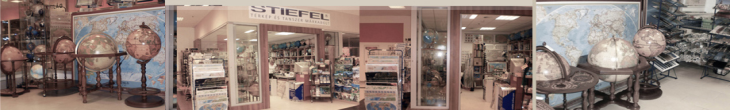
- TÉRKÉPBOLT
- DIGITÁLIS NYOMTATÁS

London - street atlasz 2023

2023
nyelv: angol
Egy színes, egyoldalas, kihajtható utcatérkép, amely a londoni Charing Crosstól számított hat mérföldes körzetet fedi le. Északon Muswell Hillig, keleten a London City repülőtérig, délen a Crystal Palace-ig, nyugaton pedig Wembley-ig terjed.
A borítóhoz egy füzet tartozik, amely több mint 40 000 utca átfogó mutatóját tartalmazza, valamint kiválasztott lakásokat, sétányokat, látnivalókat, tűzoltóságokat, kórházakat és hospice-okat a régióban.
A térképen szerepelnek az irányítószámú kerületek, az egyirányú utcák, a torlódási övezet határai és az ULEZ határai. Van egy különálló és naprakész TfL metrótérkép is.
Ez az ikonikus térkép megbízható eszköz a fővárosban való eligazodáshoz.
Nagy-Britannia vezető utcatérkép-kiadója, amely térképészeti szolgáltatásokat, digitális adattermékeket és papíralapú térképészeti kiadványokat kínál (beleértve az utcaatlaszokat, látogatói kalauzokat, a Nagy-Britannia útatlaszait és a Kalandatlaszokat).
-
ISBN 9780008581763Kiadás éve, kiadó 2023Lurdy házban lévő boltunk készlete Általában van a boltban, ha nincs, akkor kb. 1 hét.Raktárkészlet NINCS